What Do G1 Through G5 Geomagnetic Storm Levels Mean?

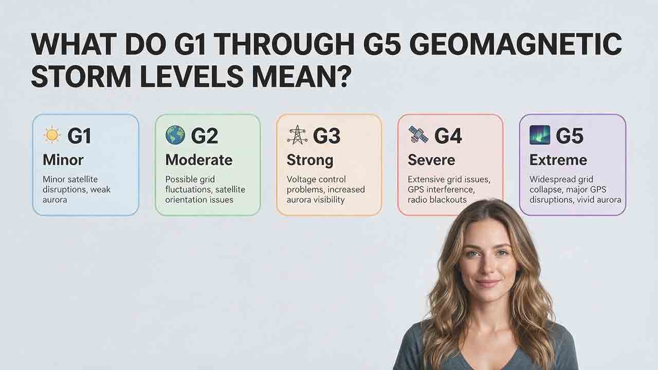
What Do G1 Through G5 Geomagnetic Storm Levels Mean?
NOAA’s G1 through G5 scale ranks geomagnetic storms from minor to extreme. G1 covers the Kp 5 range, G2 Kp 6, G3 Kp 7, G4 Kp 8 including 9−, and G5 only Kp 9o. Higher levels indicate stronger global magnetic disturbance, but they do not guarantee aurora, outages, navigation errors, or equipment damage at a specific location.
Key Takeaways
- G1 is minor and G5 is extreme. Each step represents a stronger disturbance in Earth’s magnetic environment.
- The scale is tied to the planetary Kp index. G4 includes Kp 8 and 9−, while G5 is reserved for Kp 9o.
- G levels describe possible effects, not guaranteed outcomes. Storm duration, geographic location, local geology, infrastructure design, and system sensitivity all matter.
- Higher levels generally expand aurora opportunities toward lower geomagnetic latitudes, but visibility still depends on darkness, cloud cover, light pollution, timing, and the auroral oval.
- Most people do not need special action during G1 or G2 conditions. Higher levels matter most to power-grid, satellite, aviation, navigation, radio, pipeline, and emergency-management operators.
This guide will help you decode a G1, G2, G3, G4, or G5 notice, understand what the level can and cannot tell you, and decide which additional information matters for your situation.
How Does NOAA Define the G1 Through G5 Geomagnetic Storm Scale?
The NOAA Geomagnetic Storm Scale, commonly called the G scale, communicates the severity and possible effects of disturbances in Earth’s magnetic environment.
It has five levels:
- G1 — Minor
- G2 — Moderate
- G3 — Strong
- G4 — Severe
- G5 — Extreme
The scale is based on the planetary Kp index, a standardized measure of global geomagnetic disturbance derived from magnetometer observations. NOAA uses the G scale to translate technical Kp categories into impact-oriented language for power-grid operators, spacecraft teams, radio users, navigation users, aurora observers, emergency managers, and the public.
The official definitions and possible effects are published by the NOAA Space Weather Prediction Center.
What Is the Exact Kp Category for Each G Level?
| NOAA level | Official description | Exact Kp category | Plain-language meaning |
|---|---|---|---|
| G1 | Minor | Kp 5 range: 5−, 5o, and 5+ | A relatively weak geomagnetic storm |
| G2 | Moderate | Kp 6 range: 6−, 6o, and 6+ | A moderate disturbance with more noticeable high-latitude effects |
| G3 | Strong | Kp 7 range: 7−, 7o, and 7+ | A significant storm requiring closer operational attention |
| G4 | Severe | Kp 8 range plus 9− | A major storm with potentially widespread system effects |
| G5 | Extreme | Kp 9o | The maximum standard geomagnetic storm category |
In Kp notation, the letter o indicates the central or whole category. It is the lowercase letter “o,” not the number zero.
The most easily overlooked distinction is at the top of the scale:
Kp 9− remains G4. Only Kp 9o is G5.
NOAA’s current Planetary K-index page displays the relationship as Kp 8 and 9− for G4, and Kp 9o for G5. See the NOAA Planetary K-index documentation.
What Effects May Occur at Each Level?
The following table summarizes possible effects. It does not predict that every effect will occur during every storm.
| Level | Possible technology effects | NOAA historical U.S. aurora illustration |
|---|---|---|
| G1 | Weak power-grid fluctuations and minor satellite-operational effects are possible | Commonly visible at high latitudes, including areas such as northern Michigan and Maine |
| G2 | High-latitude voltage alarms, satellite-orientation corrections, increased low-orbit drag, and high-latitude HF fading may occur | Historically observed as far south as New York and Idaho |
| G3 | Voltage corrections, protection-system false alarms, satellite charging, greater orbital drag, and intermittent navigation or HF-radio problems may occur | Historically observed as far south as Illinois and Oregon |
| G4 | Widespread voltage-control problems, unintended protective trips, satellite tracking or orientation problems, and degraded radio or navigation may occur | Historically observed as far south as Alabama and northern California |
| G5 | Widespread grid-control problems, possible blackouts, transformer stress, extensive spacecraft effects, and prolonged radio or navigation degradation may occur | Historically observed as far south as Florida and southern Texas |
NOAA’s location examples are historical U.S. illustrations based on approximate geomagnetic latitude. They are not universal forecast boundaries and do not guarantee that aurora will be visible throughout a named state.
International observers should focus on geomagnetic latitude, the current auroral oval, local darkness, cloud cover, and real-time solar-wind conditions.
What Should Different Readers Check First?
A G-level notice has different meanings for different users.
- General public: Check official local utility or emergency notices. Ordinary activities usually continue normally.
- Aurora observers: Check local darkness, cloud cover, the auroral oval, storm timing, light pollution, and a safe viewing location.
- Technical users: Follow organization-specific procedures and review system-specific measurements rather than relying on the G number alone.
The G level is an initial severity signal. It is not a complete local forecast.
What Does a G1 Minor Geomagnetic Storm Mean?
A G1 storm is the lowest level that NOAA officially classifies as a geomagnetic storm. It covers the Kp 5 range, including 5−, 5o, and 5+.
For most people, G1 primarily means improved aurora potential at high latitudes rather than widespread technological disruption. NOAA notes that weak power-grid fluctuations and minor effects on satellite operations are possible.
What should an aurora observer do during G1?
A G1 forecast may be useful when you are already near the normal auroral zone.
Check:
- Whether the forecast period occurs during local darkness.
- Whether the auroral oval extends toward your location.
- Whether clouds, haze, moonlight, or city lights will interfere.
- Whether activity is strengthening or weakening in real time.
- Whether you have a safe and unobstructed poleward view.
A G1 notice by itself is usually not a strong reason to travel a long distance from a substantially lower geomagnetic latitude.
Does G1 threaten phones or household electronics?
Ordinary household electronics are not the focus of NOAA’s G1 impact descriptions. The official concerns are weak grid fluctuations and possible minor satellite-operational effects, not direct damage to individual phones, televisions, vehicles, or appliances.
What Does a G2 Moderate Geomagnetic Storm Mean?
A G2 storm covers the Kp 6 range and represents a moderate global geomagnetic disturbance.
At this level, high-latitude electrical systems, satellites, HF-radio links, and low-Earth-orbit operations may require closer attention. Possible changes in atmospheric drag can affect orbit predictions, while ground control may need to correct a spacecraft’s orientation.
At G2, high-latitude power systems may experience voltage alarms. NOAA also notes that transformer damage is possible during long-duration storms, but this is not an expected outcome for every G2 interval or every electrical grid.
Is G2 an emergency for the public?
Not automatically.
A G2 storm is operationally relevant, but it does not mean that power outages, GPS failures, or satellite damage will occur. A brief G2 interval may have fewer consequences than a long event that repeatedly reaches G2.
The location, design, operating condition, and sensitivity of the affected system are as important as the peak level.
Who should monitor G2 conditions more closely?
G2 conditions are particularly relevant to:
- High-latitude electrical-grid operators
- Satellite and launch-operation teams
- HF-radio users operating across polar or high-latitude paths
- Aviation, marine, surveying, and timing users requiring dependable navigation
- Aurora observers at northern mid-latitudes
General consumers can normally continue their usual activities while following official information rather than dramatic social-media predictions.
What Does a G3 Strong Geomagnetic Storm Mean?
A G3 storm covers the Kp 7 range. NOAA classifies this as a strong storm because more noticeable effects may occur across power, satellite, radio, and navigation systems.
Power-grid operators may need voltage corrections, and some protection devices may produce false alarms. Satellites may experience surface charging, increased atmospheric drag in low Earth orbit, or orientation difficulties.
Intermittent satellite-navigation, low-frequency navigation, and HF-radio problems may also occur.
Does G3 guarantee mid-latitude aurora?
No.
G3 can significantly improve aurora potential at northern mid-latitudes, but visibility still requires a favorable combination of conditions:
- Local darkness
- A sufficiently expanded auroral oval
- Limited cloud cover
- Low light pollution
- A clear poleward horizon
- Activity that lasts long enough to observe
A camera may record faint green, red, or purple color before the unaided eye sees a clearly structured display.
Should GPS users expect errors during G3?
Temporary or intermittent positioning problems become more plausible during stronger ionospheric disturbances. The practical result depends on the receiver, correction service, satellite geometry, region, and accuracy requirement.
An ordinary road-navigation app and a centimeter-level surveying system do not have the same vulnerability. Precision users should review the status of their correction network and validate important measurements rather than assuming that all GPS becomes unusable at G3.
What Does a G4 Severe Geomagnetic Storm Mean?
A G4 storm covers the Kp 8 range and also includes Kp 9−. It is a severe event that can affect infrastructure and spacecraft across wider geographic regions.
NOAA lists possible widespread voltage-control problems and unintended protective-system operations. Satellite operators may encounter surface charging, tracking difficulties, and orientation problems.
HF-radio propagation may become sporadic. Satellite navigation can be degraded for hours, and low-frequency radio navigation may be disrupted.
What should the public do during G4?
Most people should follow official notices and avoid treating the G4 label as proof that a major local disruption will occur.
Proportionate actions include:
- Keep essential communication devices charged as part of normal emergency readiness.
- Confirm important navigation information through more than one source.
- Check utility or emergency-management notices if a local disruption is reported.
- Avoid repeating claims that a nationwide or global blackout is inevitable.
- For aurora viewing, verify the local weather, darkness, oval position, timing, and safety of the location.
Members of the public should not attempt improvised electrical work or interfere with utility equipment.
Why can G4 effects vary between regions?
Geomagnetically induced currents depend on more than the storm’s global G level.
Important factors include:
- The speed and direction of local magnetic-field changes
- Electrical conductivity beneath the ground
- Transmission-line length and orientation
- Network design and operating conditions
- Transformer and protection-system characteristics
- Preventive actions taken by infrastructure operators
The U.S. Geological Survey explains that geoelectric hazard varies geographically because geological structures have different electrical resistance. In the contiguous United States, some areas in the Upper Midwest and East have comparatively high modeled exposure. See the USGS overview of geology and geoelectric hazards.
What Does a G5 Extreme Geomagnetic Storm Mean?
A G5 storm corresponds specifically to Kp 9o, the maximum standard Kp category.
This is the highest level on NOAA’s geomagnetic storm scale. It indicates an extreme global magnetic disturbance with the potential for extensive effects.
NOAA lists possible widespread voltage-control and protective-system problems, blackouts or grid collapse in some systems, transformer damage, extensive spacecraft charging, satellite tracking difficulties, and prolonged degradation of some radio and navigation services.
These are possible effects, not a forecast that every listed system will fail.
Does G5 guarantee a global blackout?
No.
G5 describes the severity of the geomagnetic environment. It does not determine the outcome for every power network, country, satellite, radio path, pipeline, or navigation receiver.
Actual consequences depend on:
- Storm duration
- The speed of magnetic-field changes
- Regional geology
- Grid configuration
- Equipment condition
- System loading
- Protective procedures
- Operator response
It is inaccurate to convert “G5” directly into “global blackout.”
Is G5 a direct radiation danger to people on the ground?
The G scale is not a ground-level human-radiation scale.
NOAA uses a separate S scale for solar radiation storms and an R scale for radio blackouts associated with solar flares. A storm can have different G, S, and R levels because the three scales describe different physical effects.
The G scale primarily communicates possible effects involving power systems, spacecraft, navigation, radio propagation, pipelines, and aurora.
How Is the G Scale Related to the Kp Index?
The G scale is an impact-oriented interpretation of the planetary Kp index.
Kp is a unitless planetary index that summarizes geomagnetic disturbance using measurements from a network of ground observatories. Each formal Kp value represents a three-hour interval.
NOAA’s estimated Planetary Kp chart can update frequently as new observations arrive, but the value still characterizes a three-hour period. This means a storm may rise, fall, and return to a higher level during the same day.
The NOAA Planetary K-index page explains the three-hour measurement and how Kp is used for watches, warnings, and alerts. The GFZ Helmholtz Centre for Geosciences Kp service provides the internationally recognized official Kp index and long-term documentation.
Why Does NOAA Sometimes Show 4.67 as G1?
Some operational products express Kp categories as decimal values rather than using minus, neutral, and plus symbols.
For example:
| Decimal display | Traditional Kp notation | NOAA G level |
|---|---|---|
| 4.67 | 5− | G1 |
| 5.67 | 6− | G2 |
| 6.67 | 7− | G3 |
| 7.67 | 8− | G4 |
| 8.67 | 9− | G4 |
| 9.00 | 9o | G5 |
The important point is that 4.67 is the decimal encoding of the category 5−. It should not be interpreted as ordinary “Kp below 5” arithmetic when reading an operational table.
The full Kp 5 range includes:
- 4.67 = 5−
- 5.00 = 5o
- 5.33 = 5+
All three belong to G1.
Similarly, 8.67 represents 9− and remains G4. Only 9.00, or 9o, is G5.
GFZ’s file-format documentation explains that decimal values are used in data files—for example, 0.667 instead of the traditional 1− notation. See the GFZ Kp data and format documentation.
Why Is Kp Not a Complete Local-Impact Forecast?
Kp summarizes planetary geomagnetic activity. It does not directly reveal:
- Conditions at one exact city
- The local rate of magnetic-field change
- Ground conductivity below a particular transmission line
- The vulnerability of a specific transformer or satellite
- The health of a particular GNSS correction network
- Local cloud cover or darkness
- Whether aurora will be overhead, low on the horizon, or visually detectable
Kp and the G scale are valuable starting points. Specialized users still need local measurements, system-specific models, and their own operating procedures.
How Should You Read a NOAA Geomagnetic Storm Notice?
Use the Scale–Status–Window–Location–System framework.
This five-part method prevents one global number from being mistaken for a complete local forecast.
Step 1: Identify the scale
Confirm that the notice says G1–G5.
- G scale: Geomagnetic storms
- S scale: Solar radiation storms
- R scale: Radio blackouts
The scales are related to space weather, but they are not interchangeable.
Step 2: Identify the product status
Determine whether the information is a forecast, watch, warning, or alert.
NOAA uses K-index products in different ways:
- Watches are issued for predicted geomagnetic storm levels.
- Warnings are issued when specified K-index conditions are expected.
- Alerts report that an observed K-index threshold has been reached.
A watch is not proof that the predicted peak will occur. An alert is evidence that a threshold has been observed.
Step 3: Read the UTC validity window
NOAA space-weather products normally use Coordinated Universal Time, or UTC.
Convert the start and end of the relevant period into local time. Check the date carefully because an interval near midnight UTC may fall on a different local calendar day.
For aurora observers, a peak during local daylight may have little immediate viewing value even when the storm level is high.
Step 4: Evaluate the location
Ask whether your location or system is especially exposed.
Relevant considerations include:
- Geomagnetic latitude
- Distance from the auroral oval
- Polar or high-latitude communication paths
- Regional geology
- Local magnetic-field measurements
- Local weather and darkness
- Whether the system uses long grounded conductors
Geographic latitude alone is not a precise aurora or infrastructure-impact boundary.
Step 5: Match the level to your system
| User | Most useful information after checking the G level |
|---|---|
| Aurora observer | Auroral oval, local darkness, cloud cover, moonlight, horizon, and timing |
| General consumer | Official local utility and emergency notices |
| HF-radio operator | Path latitude, operating frequency, ionospheric conditions, and real-time propagation reports |
| Precision GNSS user | Correction-service status, receiver performance, satellite geometry, and ionospheric monitoring |
| Satellite operator | Orbit, charging conditions, drag, attitude control, communications, and mission procedures |
| Power-grid operator | Regional magnetic variation, geoelectric fields, loading, network configuration, and protection status |
How Would You Interpret a Real G3 Watch?
Suppose NOAA issues a G3 watch for a six-hour UTC period.
An aurora observer should not interpret that notice as “G3 aurora will be visible overhead for six hours.”
A more reliable process is:
- Confirm that G3 is forecast rather than already observed.
- Convert the complete UTC interval into local time.
- Check whether the period overlaps local darkness.
- Review the forecast auroral oval.
- Monitor real-time Kp and solar-wind conditions as the event approaches.
- Check cloud cover, moonlight, and light pollution.
- Choose a safe location with a clear poleward horizon.
- Allow for the storm to arrive early, late, weaker, or stronger than forecast.
A precision-surveying team would use the same G3 watch differently. The team might review its correction-network status, move the most accuracy-sensitive work outside the expected peak where practical, and validate results against independent control points.
The storm level is the same. The decision changes with the user and the system.
How Should Different Users Respond at Each Level?
The following table is a practical interpretation guide, not an emergency directive.
| Level | General public | Aurora observers | Technical and infrastructure users |
|---|---|---|---|
| Below G1 | No storm-related action is normally required | Aurora may still be visible at high latitudes | Routine monitoring |
| G1 | Continue normal activities | Check conditions if near the normal auroral zone | Note possible minor effects |
| G2 | Follow official updates without alarm | Northern mid-latitude observers may prepare | Review high-latitude and low-orbit exposure |
| G3 | Check local information if disruptions are reported | Monitor the oval, timing, and weather closely | Apply organization-specific procedures |
| G4 | Maintain normal emergency readiness and use official sources | Wider viewing opportunity if dark and clear | Increase operational monitoring |
| G5 | Follow government, utility, and service-provider instructions | Potentially broad viewing opportunity, with no visibility guarantee | Execute established severe-space-weather plans |
What Are the Strengths and Limitations of the G Scale?
The G scale is effective because it converts technical geomagnetic measurements into five recognizable impact categories.
Its simplicity is also its main limitation.
| Strength | Limitation |
|---|---|
| Provides a clear five-level severity system | Can be mistaken for a guaranteed local-impact forecast |
| Connects directly to planetary Kp | Kp represents broad planetary conditions |
| Lists possible effects by system type | Does not measure the vulnerability of a particular system |
| Supports watches, warnings, alerts, and public communication | Does not include local cloud cover, darkness, or light pollution |
| Makes different storms easier to compare | Does not replace local magnetic, ionospheric, grid, or satellite data |
The best use of the G scale is as an initial decision signal, followed by information specific to the location, system, and activity.
Which Common Mistakes Lead to Bad Storm Interpretations?
Mistake 1: Treating a watch as an observed storm
A watch describes forecast potential. It does not confirm that the predicted threshold has been reached.
Check the product label, issue time, validity period, and subsequent alerts.
Mistake 2: Assuming the highest daily level lasts all day
Kp is organized into three-hour intervals.
A day described as “G3 possible” may contain one G3 interval surrounded by quieter conditions. The timing of the peak matters for both technical operations and aurora viewing.
Mistake 3: Treating historical aurora locations as fixed boundaries
NOAA’s state examples show how far south aurora has historically been reported during certain levels. They do not establish a guaranteed southern edge.
Aurora may be:
- Overhead or low on the horizon
- Bright or barely visible
- Brief or sustained
- Visible to a camera but difficult to see by eye
- Hidden by clouds or daylight
Mistake 4: Assuming G5 means an inevitable global blackout
G5 identifies extreme geomagnetic conditions. It does not determine a single universal infrastructure outcome.
Grid effects depend on storm behavior, regional geology, network design, equipment, operating conditions, and protective actions.
Mistake 5: Confusing a geomagnetic storm with a solar flare
A solar flare and a geomagnetic storm are separate phenomena.
A flare can cause an R-scale radio blackout soon after its radiation reaches Earth. A geomagnetic storm develops when solar-wind conditions interact effectively with Earth’s magnetic environment.
Coronal mass ejections and high-speed solar-wind streams are major geomagnetic-storm drivers. NOAA provides a technical overview on its Geomagnetic Storms page.
Mistake 6: Assuming every electronic device has the same exposure
Large power networks, pipelines, satellites, HF-radio systems, precision navigation equipment, vehicles, and household electronics have very different exposure mechanisms.
A warning relevant to a long grounded transmission line does not automatically imply direct damage to a phone or small appliance.
Why Might a Forecasted Storm Be Weaker or Stronger Than Expected?
Forecast uncertainty is unavoidable because storm severity depends strongly on the magnetic field carried by the arriving solar wind.
A coronal mass ejection may arrive earlier or later than forecast. Its internal magnetic field may also be more or less favorable for transferring energy into Earth’s magnetosphere.
A sustained southward component of the interplanetary magnetic field is particularly effective at driving geomagnetic activity.
Why might a G3 forecast produce only G1?
Possible explanations include:
- The solar disturbance partly missed Earth.
- Its magnetic field was less geoeffective than expected.
- Strong conditions lasted only briefly.
- Its speed or internal structure differed from model estimates.
Why might a G1 forecast become G3 or G4?
Possible explanations include:
- The arriving magnetic field was stronger than expected.
- The field remained southward longer than forecast.
- Multiple solar-wind structures interacted.
- Real-time measurements revealed a more effective configuration.
A changing forecast does not necessarily indicate careless forecasting. Before the disturbance reaches near-Earth monitoring spacecraft, its internal magnetic orientation cannot always be determined precisely.
Why Might You See No Aurora During a Strong Storm?
A high G level improves the opportunity but cannot overcome poor viewing conditions.
Check the following:
- Was it fully dark?
- Did the auroral oval reach your region?
- Did the strongest interval occur before or after you looked?
- Were clouds, haze, smoke, moonlight, or city lights present?
- Did you have a clear view toward the relevant pole?
- Was the aurora low on the horizon?
- Was it visible mainly to a camera?
- Did the peak last for only a short interval?
NOAA emphasizes that Kp-to-aurora relationships are approximate and apply to geomagnetic rather than ordinary geographic latitude. See NOAA’s aurora-viewing guidance.
What Should You Check Before Acting on a G1–G5 Forecast?
Use this checklist:
- Confirm that the notice uses the G scale, not the R or S scale.
- Check whether it is a forecast, watch, warning, or observed alert.
- Record the issue time and valid UTC window.
- Convert the full window correctly to local time and date.
- Determine whether the level is a brief peak or a sustained expectation.
- Match the forecast to your actual concern: aurora, GPS, radio, satellites, pipelines, or power.
- Review local weather and darkness for aurora viewing.
- Check for updated NOAA products as the event approaches.
- Follow system-specific or local official instructions where applicable.
- Treat dramatic headlines and unsourced social-media maps as secondary information.
What Does This Article Not Claim?
This article does not:
- Predict a specific future geomagnetic storm
- Guarantee aurora visibility
- Predict a blackout at a particular location
- Estimate the failure probability of a specific satellite, transformer, receiver, vehicle, or electronic device
- Replace utility, aviation, satellite, maritime, emergency-management, or engineering procedures
- Represent approval or endorsement by NOAA, USGS, GFZ, or another government or research organization
This guide is based on public authoritative documentation and practical interpretation criteria. It does not use private utility, satellite, or emergency-management data.
How Should You Use the G Scale in Practice?
Use the G number to answer one initial question:
How disturbed is Earth’s magnetic environment expected to become?
Then add four pieces of context:
- Is the level forecast or already observed?
- When will the relevant interval occur locally?
- Is your location or system especially exposed?
- Which real-time or system-specific data confirms the practical effect?
For most readers, G1 and G2 are monitoring events rather than emergencies. G3 deserves closer attention for aurora planning and technical operations. G4 and G5 justify heightened awareness and established professional procedures, but neither level guarantees the same outcome in every region.
What should you do next?
- For aurora viewing: Check the oval, UTC timing, local darkness, cloud cover, and a safe observing location.
- For ordinary household concerns: Follow official utility and emergency notices rather than making decisions from the G number alone.
- For precision navigation or radio work: Review service-specific ionospheric and operational data.
- For infrastructure or spacecraft operations: Follow established organizational procedures and local measurements.
Frequently Asked Questions
Can a geomagnetic storm change from G1 to G4 in the same day?
Yes. Kp is assessed in three-hour intervals, and conditions can intensify, weaken, and intensify again. The maximum level reported for a day does not describe every hour of that day.
Is G5 the same as an X-class solar flare?
No. G5 describes an extreme geomagnetic storm in Earth’s magnetic environment. An X-class designation describes the X-ray intensity of a solar flare and is more directly connected to NOAA’s R-scale radio-blackout categories.
A strong flare does not automatically produce a G5 storm.
Can aurora appear when conditions are below G1?
Yes. Aurora is routinely visible at sufficiently high geomagnetic latitudes when Kp remains below the G1 threshold.
The G scale measures the severity of global geomagnetic disturbance. It is not the minimum requirement for all aurora.
Why do different websites show different Kp values?
Different services may display forecast, estimated, nowcast, provisional, or finalized Kp values. They may also update at different times or use decimal versus traditional minus, neutral, and plus notation.
Check the timestamp, data type, interval, and source before comparing two numbers.
Should I unplug electronics during a G3 or G4 storm?
NOAA’s G-scale descriptions do not provide a general instruction for households to unplug ordinary electronics solely because a G3 or G4 storm is forecast.
Follow instructions from your local utility or emergency authorities if a regional electrical problem is reported.
Can a G1 storm disrupt GPS?
Minor ionospheric effects are possible during geomagnetic activity, but many ordinary users may notice no problem.
Precision positioning, high-latitude navigation, and systems requiring continuous accuracy are more sensitive and should use service-specific monitoring and validation.
How Was This Article Reviewed?
This guide was checked against:
- NOAA’s current G1–G5 geomagnetic storm definitions
- NOAA’s Planetary K-index documentation
- NOAA operational three-hour Kp forecast formatting
- NOAA aurora-viewing guidance
- U.S. Geological Survey geoelectric-hazard materials
- GFZ Kp documentation and data-format guidance
Official scale definitions are separated from practical interpretation. No private operational information, unpublished testing, or claimed expert endorsement was used.
The page should be reviewed whenever NOAA changes its space-weather scale definitions, Kp product formatting, or alert terminology. The review date should not be changed unless a substantive source or content check has been completed.
Sources
Sources reviewed August 3, 2026.
NOAA Space Weather Prediction Center — NOAA Space Weather Scales
Official G1–G5 thresholds, descriptions, possible effects, and historical U.S. aurora illustrations.NOAA Space Weather Prediction Center — Planetary K-index
Official mapping of Kp 5 through 9o to the G scale, three-hour measurement details, and watch, warning, and alert information.NOAA Space Weather Prediction Center — Geomagnetic Storms
Overview of geomagnetic-storm drivers and effects on power, satellites, navigation, radio, and pipelines.NOAA Space Weather Prediction Center — Tips on Viewing the Aurora
Guidance on Kp, geomagnetic latitude, darkness, timing, location, and the limitations of aurora boundaries.NOAA Space Weather Prediction Center — 3-Day Forecast
Operational example of three-hour Kp forecast formatting. The contents of this live product change over time.GFZ Helmholtz Centre for Geosciences — Geomagnetic Kp Index
Stable overview of the internationally recognized Kp index, its production, and its scientific role.GFZ Helmholtz Centre for Geosciences — Kp Data and Format Documentation
Kp data access and documentation for decimal file formats, nowcast values, and definitive records.U.S. Geological Survey — The Solar Cycle, Geology, and Geoelectric Hazards for Power Grids
Explanation of how magnetic storms, ground conductivity, and regional geology affect geoelectric exposure.U.S. Geological Survey — Magnetic Storms and Geoelectric Hazards
Scientific review of geomagnetic disturbance, local surface impedance, and risks to grounded long-line systems.
More from Forecast Tools & Alerts
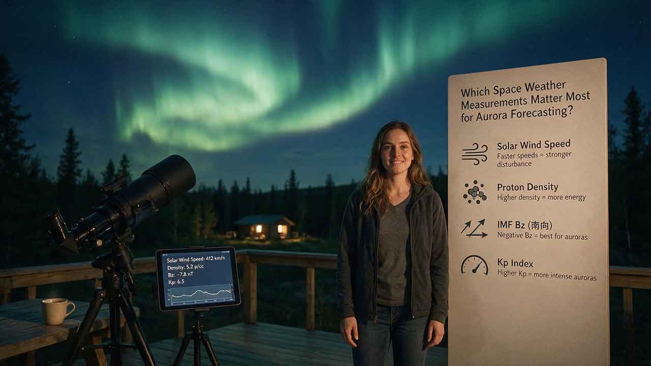
Which Space Weather Measurements Matter Most for Aurora Forecasting?
Aurora forecasting becomes more reliable when each space weather measurement is used for the right decision window. This guide explains why CME direction and propagation models matter several days ahead, while sustained southward Bz, total magnetic-field strength, solar-wind speed, density, and dynamic pressure become more useful as a disturbance approaches Earth. It also shows how Kp, auroral-oval maps, hemispheric power, AE, Dst, and local magnetometers answer different forecasting questions. Readers will learn a practical Signal–Coupling–Response–Visibility framework, compare upstream warning time with NOAA’s auroral-model guidance, work through a dynamic-pressure example, and troubleshoot conflicting forecast signals. The article also explains commonly overvalued indicators, including flare class, isolated Bz spikes, and Kp values without local-time context. Designed for aurora viewers, photographers, and travelers, it provides a clear checklist for combining official space weather data with darkness, cloud cover, road safety, and horizon visibility—without promising that any single measurement can guarantee a visible display.
How Reliable Are Aurora Forecast Apps?
Aurora forecast apps are useful for identifying periods of elevated geomagnetic activity, but they cannot guarantee that the northern lights will be visible from a specific location at a specific time. This guide explains why app alerts sometimes disagree, how forecast reliability changes as an event approaches, and which measurements deserve the most attention. Readers will learn how to interpret the auroral oval, observed and forecast Kp, solar-wind speed, Bz, cloud cover, darkness, timestamps, and official space-weather alerts. The article also introduces the Signal-to-Sky Reliability Framework, a viewing-location comparison tool, and a transparent method for auditing app notifications without inventing accuracy claims. Practical tables, troubleshooting guidance, and a step-by-step verification process help casual observers, photographers, travelers, and lower-latitude aurora chasers decide when an alert is worth acting on. The guide is based on authoritative documentation and published research rather than hands-on commercial app rankings.
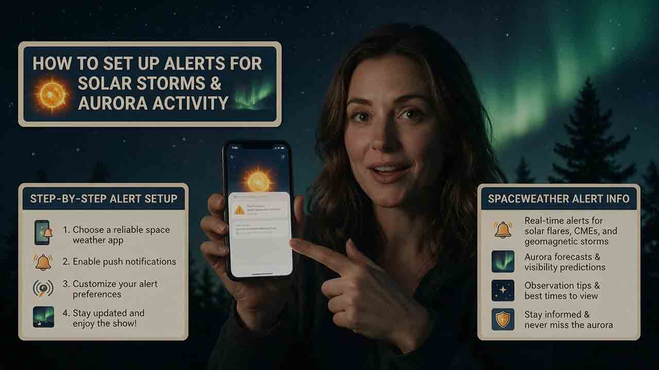
How to Set Up Alerts for Solar Storms and Aurora Activity
This practical guide explains how to build a reliable alert system for solar storms and aurora activity using official NOAA space-weather messages, location-aware aurora tools, and local weather forecasts. It clarifies the differences between forecasts, watches, warnings, and observed-threshold alerts, then shows readers how to select useful geomagnetic products, choose location-appropriate Kp thresholds, convert emails into phone notifications, and verify alerts with current auroral oval, darkness, and cloud information. The article also introduces the Three-Layer Alert Stack, Four-Gate Go-or-No-Go Check, and Two-Trigger Rule to help readers avoid acting on a single notification. Separate recommendations are included for casual observers, photographers, travelers, Southern Hemisphere viewers, amateur radio operators, and technical users. Troubleshooting steps, a notification-delivery audit, custom-alert guidance, common mistakes, and a pre-departure safety checklist make the guide useful for both initial setup and ongoing maintenance.
Explore More Topics
How to Photograph the Northern Lights
Photographing the Northern Lights requires more than choosing one fixed camera setting. This practical guide explains how to select a camera and lens, focus accurately on stars, stabilize your equipment, and adjust shutter speed, aperture, and ISO according to the aurora’s brightness and movement. It includes starting settings for fast, moderate, and faint displays, along with a Motion–Brightness–Foreground framework that helps photographers make better decisions as conditions change. Readers will also learn how to use a smartphone Night mode, compose a stronger foreground, protect color-channel highlights, edit images responsibly, and disclose exposure blends clearly. A quick-reference card, three-frame comparison method, packing checklist, safety guidance, and detailed troubleshooting table make the article useful in the field. The guide relies on published guidance from NASA, NOAA, Nikon, Canon, and Apple while clearly distinguishing authoritative information from adjustable photography recommendations.
How Far South Can the Northern Lights Be Seen?
The northern lights usually remain within high-latitude regions, but powerful geomagnetic storms can carry visible aurora surprisingly far south. This guide explains why there is no single worldwide southern boundary and shows how geomagnetic latitude, the auroral oval, Kp, storm intensity, emission altitude, darkness, cloud cover, and local light pollution affect what an observer may see. It examines NOAA’s generalized U.S. visibility examples for G1 through G5 storms, while clarifying that locations such as Alabama, Florida, and southern Texas represent rare historical possibilities rather than guaranteed forecast limits. Readers will also find an original four-gate decision framework, an auditable geometric viewing-distance example, regional viewing guidance, a practical checklist, and troubleshooting advice for distinguishing faint aurora from clouds or artificial sky glow. The article helps observers decide when a forecast justifies going outside or traveling to a safer, darker viewing site.
What Are the Best Conditions for Seeing the Northern Lights?
The best Northern Lights viewing conditions occur when geomagnetic activity, clear weather, darkness, and a suitable observing location align. This guide explains why the position of the auroral oval matters more than relying on a single Kp value and shows how cloud cover, twilight, light pollution, moonlight, atmospheric transparency, and horizon visibility affect what an observer can see. It introduces the Five-Gate Aurora Viewing Framework, a practical planning tool that evaluates aurora activity, clouds, darkness, location, and available viewing time without presenting the result as a guaranteed probability. Readers will also learn how to compare short- and long-range forecasts, convert UTC forecast periods, choose a safe dark-sky site, recognize faint aurora, and troubleshoot a promising forecast that produces no visible display. The article is based on guidance from NOAA, NASA, the University of Alaska Fairbanks, and the National Park Service.